
Wellington, situated at south western tip of North Island between Cook Strait and Rimutaka Ranges, is the windest city in New Zealand with a population of 400k. The urban area lies across four cities including Wellington city, Porirua City, Lower and Upper Hutt Valley. The district was said to be discovered by The Kupe in about 19th century and European settlers began the arrival at the mouth of Hutt River from 1839-40. Wellington was named after first duke of Wellington Arthur Wellesley who was the victor of Battle of Waterloo. The city suffered serious damages in a series of earthquakes in years 1848 and 1855 when it was first declared as the capital of the country. It replaced Auckland due to its harbor and central location. The population was then less than 5000 only. It was ranked 12th place on the list for quality living in the world.


Wellington harbor and cable car viewed from Kelburn and Wellington Botanic Garden.


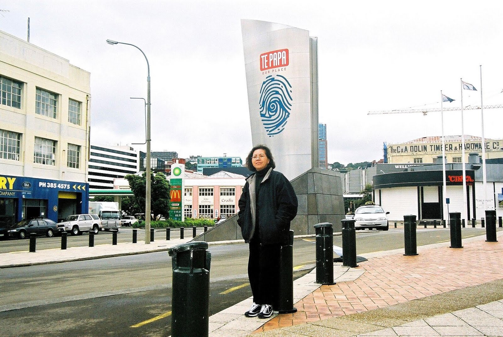
Te-papa Tongarewa, The Museum of New Zealand.m3


The shopping street at town is cozy and leisure.


The historic red-brick building Turnbull House is just on the side of Government buildings. The orange painted building on right is University of Victoria which was on the hill west of the city with about 17k full time students mainly of European descendants.


The square marble built Parliament Buildings which were built in 1922 and The copper domed circular Beehive are adjacent to each other. Beehive, constructed in late 1970s on reclaimed land is The Cabinet offices where administration and finance of the country are at work.


Wellington city is one of the four cities which formed up the capital Wellington and is overlooked by the other regions from the north and east side. Many suburbs sit high above the center of the city.


Picturesque boat harbor and Wellington Harbor where the traffic of North and South Island are linked. The huge inter-island ferries taking 3 hours to travel a few times a day cruising people and cargo from Wellington to Picton by a systematic flight boarding way.


Lower Hutt and Upper Hutt if together are known as Hutt Valley. It is the suburban areas at North East of the city. New settlements in Hutt Valley overlooking the hills in Porirua basin.


Tiered suburbs of colonial villas at Hutt Valley. People moving from city to suburbs is a trend in the last 50 years and Hutt Valley became new homeland for many New Zealanders.


The rocks shore platforms and gravel beaches along the coast of Miramar Peninsular. Many ships had been wrecked at The Barrett Reef at the area.


The raw sea weed at the rocky shore at Miramar Peninsular.


Looking deep into this direction of vast sea, South Pole of the earth is down at the end.


At an area of 6.5 km long by 2.5 km in width, Miramar Peninsular has many private residential commercial properties and large number of landowners.


Feeding sea-gull early in the morning at the blue ocean in Lower Hutt.


(1) Yip family are from Malaysia and now citizens of New Zealand and they enjoy the casual and leisure natural life style of the country (3) Priddle and Norma are of Irish origins but their family started rooted in New Zealand since century ago. (2) Mr Priddle welcomed us with the Pacific famous Bluff Oyster at his home.


A small Japanese koi with colorful carps nested in a garden of fruit plants, herbs and flora at Priddle House in Lower Hutt.


The home of Norma and Priddle at Kari Road, named after the Kari tree along the road.


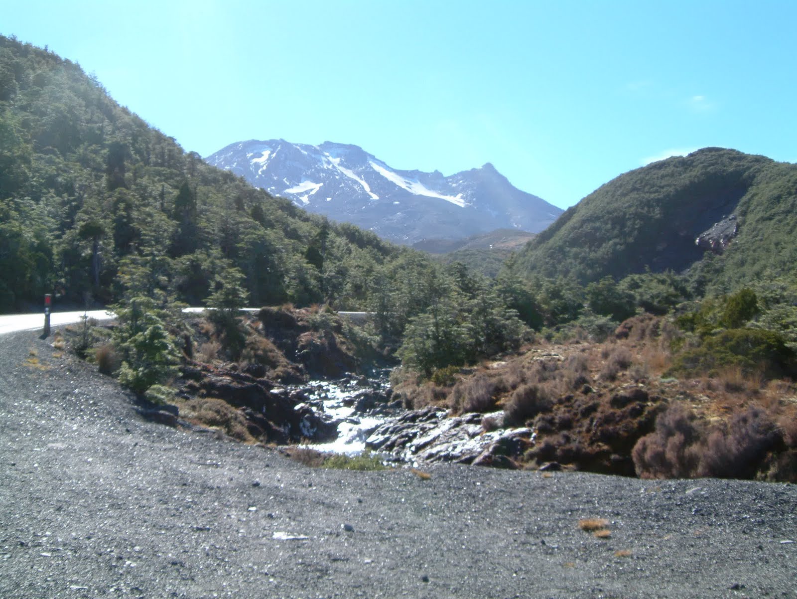
Mt. Ruapehu which means exploding hole is a perpetually snow-capped multiple volcano with a flattened summit stretching 3 km in size. It located within the 7600 sq. km Tongariro National Park with an altitude of 2797 meters and is the major ski area of the North Island.


Another two volcanic mountains at the same area are Mountians of Tongariro which has a height of 1967 meters and Ngauruhoe with a summit of 2287 meters.


The mountain tops were sacred to Maori of Ngati-Tuwharetoa tribe but were gifted to Federal Government as New Zealand first national park to protect them from exploitation.


Turoa Ski Area is one of the most famous skiing center in North Island.


The breathtaking scenic vast horizon viewing down from the mountain tops.


The cone shaped Mt Ngauruhoe is an active volcano .


In winter, visitors flock to the park to ski at the three ski areas at Mt Ruapehu and enjoy the hiking or walking in summer at the area.


Mangawhero Walls at view point 200m.


The water fall plunged down a steep rock face.


The Ohakune Mountain road in Tongariro National Park which was first national park of New Zealand, created in1887 to protect much of the landscape at central north island.


Ohakune, located at the southern end of Tongariro National Park, was formerly a railway and timber town. It is a gateway to Mt Ruapehu and a ski base for Turoa Skifield. neighborhoods like Raehiti are forestry, market gardens and farm centers.


We had fresh strawberry and blue berry from farm for our breakfast.


Herds of cows and sheep along the way, leisurely at vast area of green or under hill foot.


Remarkable scenic way traveling from Taupo to Wellington.


Taupo, 380 km away from Wellington, is a tourist center offering panoramic views of lake and volcanic mountains of Tongarino National Park to the north. Lake Taupo is renown for its trout fishing mecca as water flow and out of the lake are full of trout.


No comments:
Post a Comment